

Cycling at Kitsilano Beach
The sublime seaside

Vancouver and its surrounding neighborhoods are a cyclist’s paradise. Marked paths (both gravel and paved), dedicated bike-only options, and shared bike lanes on busier streets make riding seem downright safe, even in densely populated downtown areas. Our home-away-from-home for the moth of July is Kitsilano, a.k.a. Kits Beach, just south of downtown proper. It’s a bustling little sea-side town with tons of restaurants, shopping, parks, tree-lined streets, and swim beach access. It’s a very diverse, active, and vibrant community with people always outdoors - walking, cycling, hanging out at beaches, bars, and restaurants or engaging in recreational sports activities. I’ve never seen so many dogs! This must rank as one of the top places in the world to be a dog.
Exploring a new area by bike is the perfect way to get a feel for the landscape, terrain, people/culture, and nearby offerings. The first bike ride I took was a morning outing with Penny soon after we arrived in town. We headed east on the seaside trail that follows the shoreline away from the town beach. The path quickly turned from gravel to pavement as it wound its way scenically through a large park, past some museums and marinas toward the Granville Bridge. If you’re not familiar with the area, Kitsilano is separated from the peninsula of downtown Vancouver by several bridges, one of them rising stately above an area called Granville Island, which is actually another peninsula, but this one man-made.
Granville Island is now a popular artist and retail enclave, but has a rich industrial manufacturing history. In fact, there’s still a working concrete plant there that stands out in stark contrast to the steady stream of shoppers and tourists walking the streets. It’s definitely worth visiting Granville Island and checking out the shops, especially the Public Market. My advice is to park and secure your bike and then explore by foot1. Where the seaside bike trail meets the Granville Bridge I turned around and headed back toward Kitsilano. The trail does continue past the bridge and that amazing adventure will be chronicled in a future writing.


As Penny and I headed back toward Kitsilano on this overcast day, I appreciated the maritime sights of this area that aren’t available back in Colorado. Bridges, ships, docks, boats — all the trappings of the nautical world. These, combined with the coastlines, waterways, skyscrapers, and mountains makes the scenery here so unique and hard to rival.
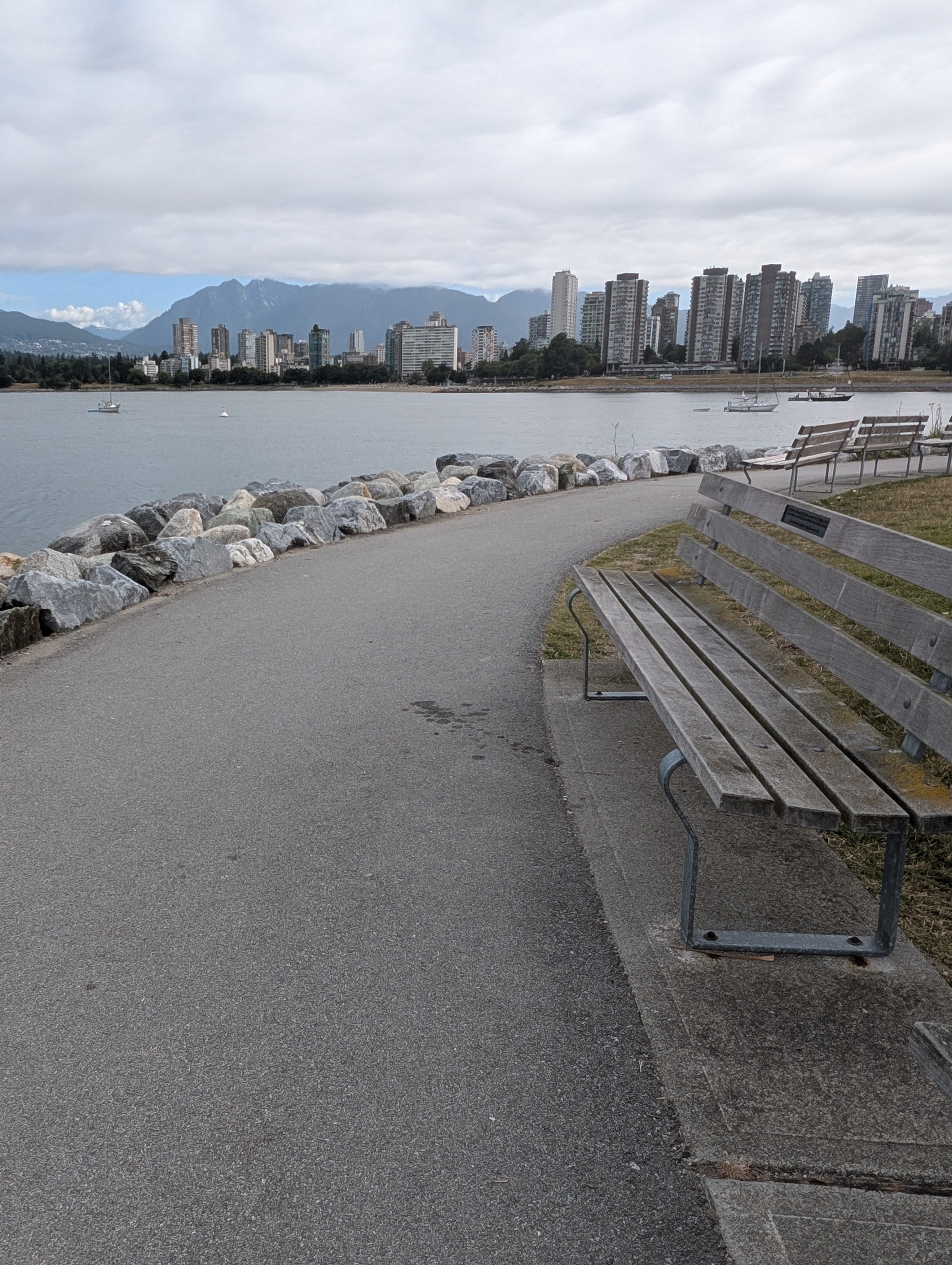
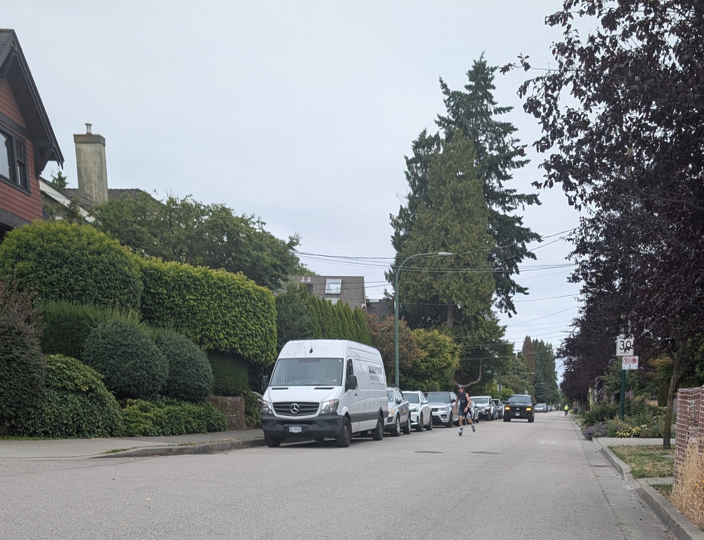
Once back in Kits Beach, I decided to continue riding west to see what was beyond the confines of our little neighborhood. Just a bit past the beach park, there’s a stretch of the bikeway that takes you through some quiet neighborhood roads and then onto a heavier trafficked road called Point Gray which has its own dedicated two-way lane for bicyclists. Here you can see the water just to the north and homes to the south. Every few minutes you pass through another park or public beach. Penny and I went through several of these, finally stopping and turning back at Spanish Banks Beach, almost the westernmost terminus before the shoreline suddenly banks south. Now I wish we’d traveled just slightly farther to see the University of British Columbia, which is nestled there on that western edge.
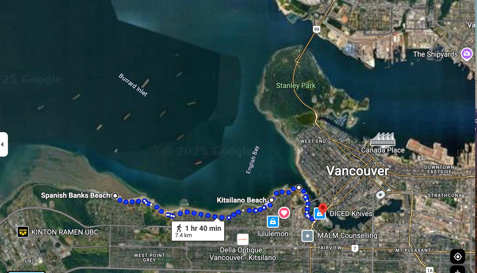
This entire ride was probably about 10 miles (or around 16 km, as they say here.) My route follows the blue dots on this Google Maps screenshot, with the heart being our home base. It was a perfect introduction to the area and the numerous bike and walking trails to be found here.
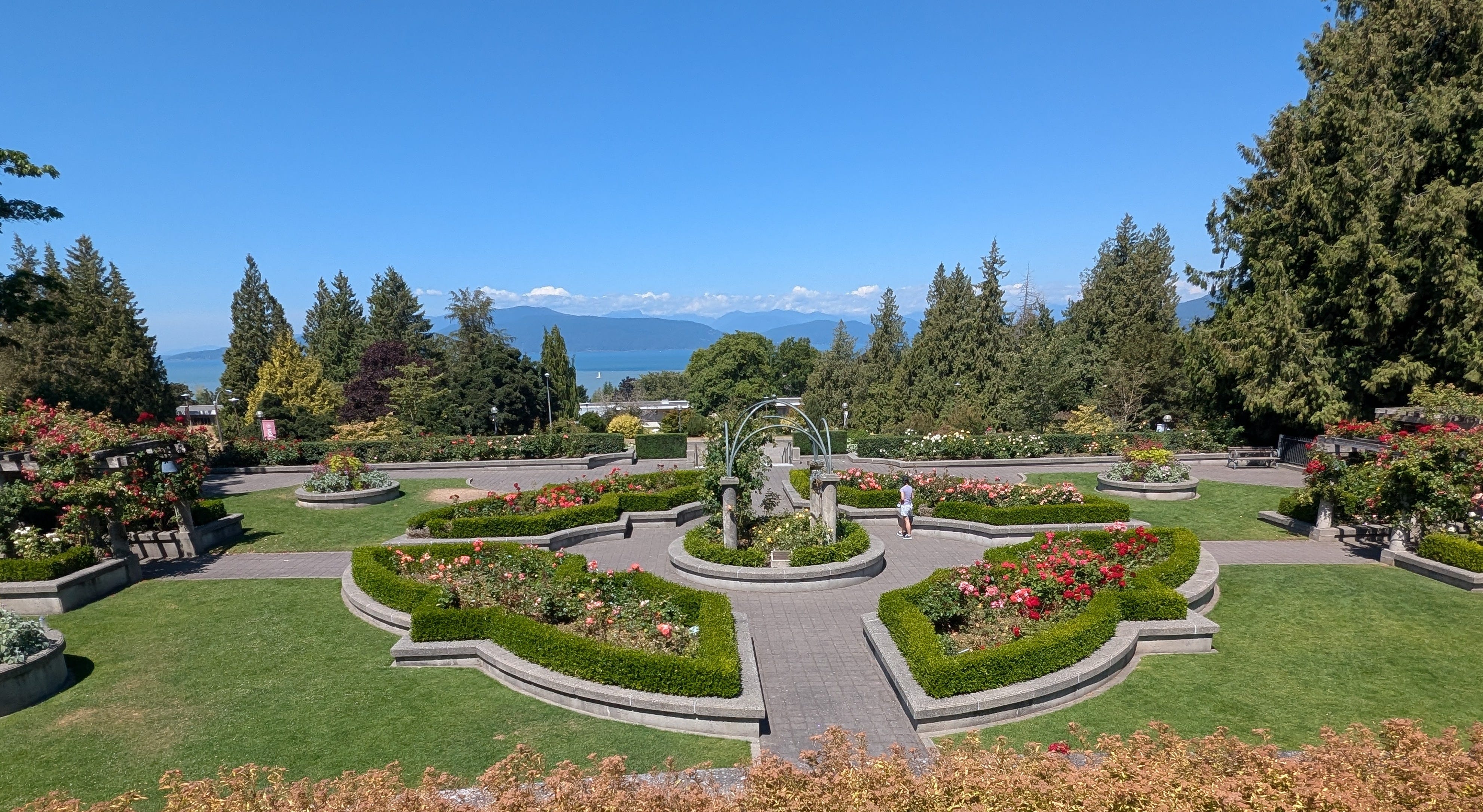
UPDATE ON JULY 24: I’ve never done this before, but I’m making an addendum to this entry. I rode further west on the seaside trail today to the University of British Columbia. I set the campus rose garden in Google Maps as my destination. It was 10 km (approx. 6 miles) each direction from the house. The seaside views were amazing in both directions and the university is very picturesque (see below). I should mention that there’s a fairly long but gradual uphill stretch that leads up to UBC’s campus. But there is a dedicated trail next to the road. As it turns out, the road wasn’t heavily traveled today, perhaps because it’s summer and the university is fairly quiet.


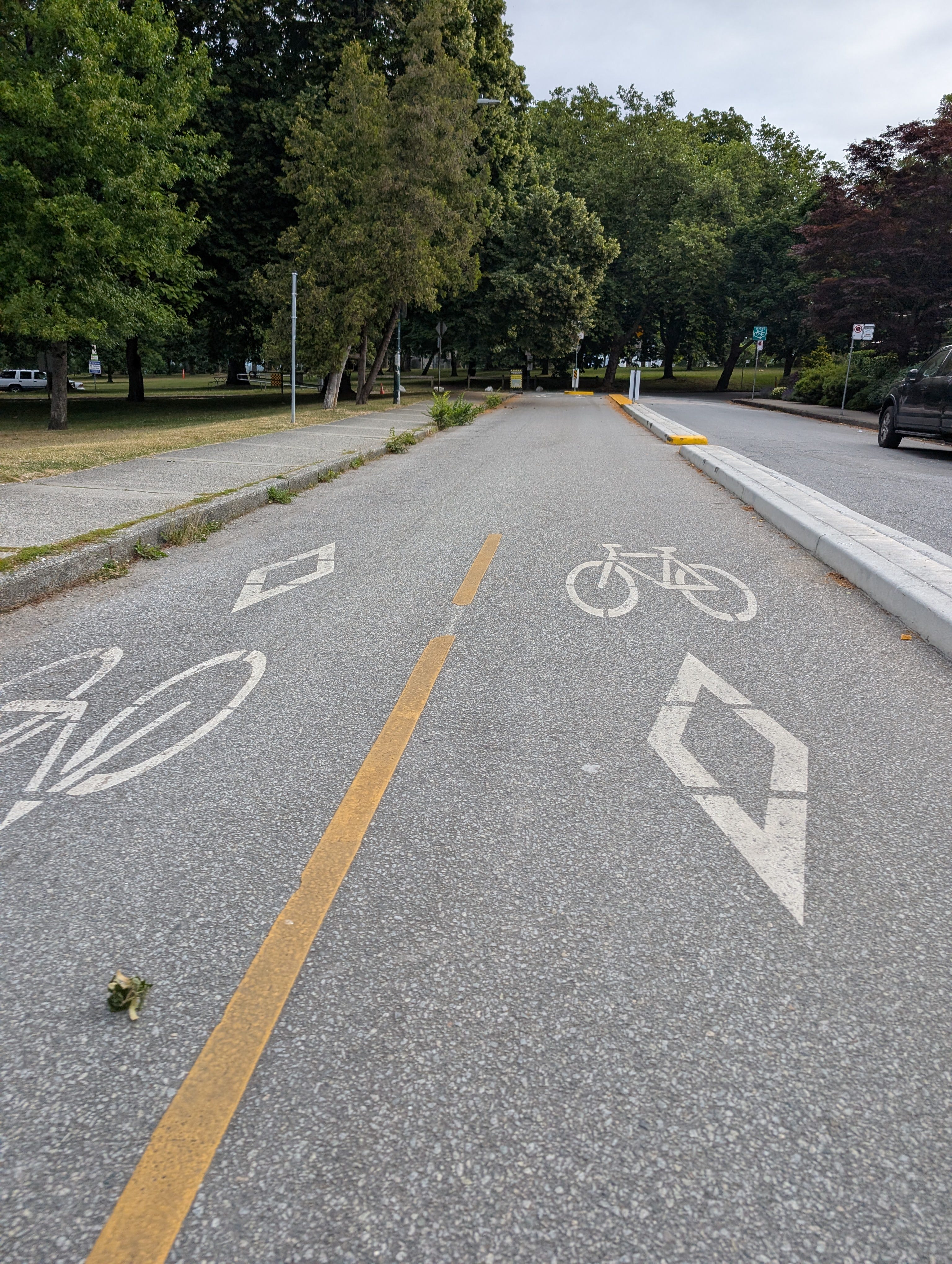
Also of note, most of the seaside bike paths are gravel (with a few quiet streets mixed in as mentioned above), but there are also some areas where you can choose a paved bike lane on the road instead. I always chose the seaside trail to stay away from cars and to get the best scenery.


There is free guarded bike parking available behind the brewery. It’s a fenced area with a person monitoring the entrance. You’re issued a number just like a coat check. There are also a lot of bike racks around the island you can use instead.